Sunday, November 12, 2006
Do you know what zone you're in?
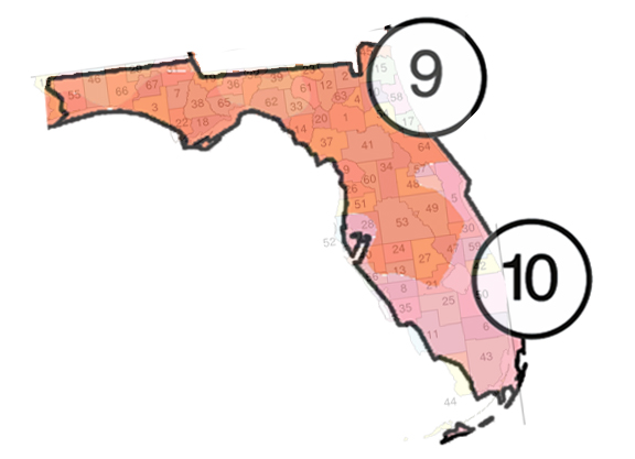
The National Arbor Day Foundation has a startling map that demonstrates the reality of climate change over a very short period of time. Based on the most recent fifteen year’s data available from more than five thousand National Climatic Data Center cooperative stations across the United States. In the period between 1990 and 2004, Zone 10 has crept significantly north in Florida, enveloping most of Brevard County and some of Seminole County. South Voludia County is now the southern-most border of Zone Nine, which has pushed its way north out of Florida and into coastal Georgia and South Carolina. I Photoshop-ed a map of Florida counties onto NADF's revised zonal map:

Subscribe to:
Post Comments (Atom)
1 comment:
The Florida Climate Center has published a similar map at www.coaps.fsu.edu/climate_center/images/ECOLD.JPG that delineates subzones A and B. You may find it interesting to know that the Arbor Day map is almost identical to the USDA map that existed prior to 1990 which put Tampa in Zone 10, Savannah and Norfolk in Zone 9, and Atlanta in Zone 8.
Post a Comment